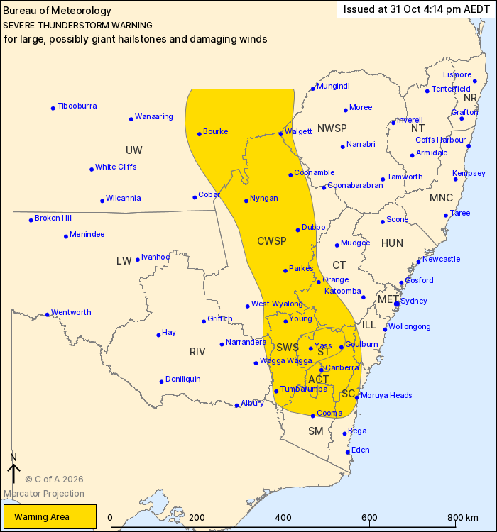
VERY DANGEROUS THUNDERSTORMS are likely to produce large, possibly giant hailstones and damaging winds over the next several hours in parts of the Southern Tablelands, Central Tablelands and South West Slopes districts. Locations which may be affected include Goulburn, Yass and Crookwell.
Severe thunderstorms are likely to produce damaging winds and large hailstones over the next several hours in the Southern Tablelands, Central West Slopes and Plains, South West Slopes, Australian Capital Territory and parts of the Illawarra, South Coast, Central Tablelands, Upper Western, Snowy Mountains, North West Slopes and Plains and Riverina districts. Locations which may be affected include Orange, Canberra, Goulburn, Dubbo, Bourke, Batemans Bay, Yass, Walgett, Parkes, Moruya Heads, Coonamble and Nyngan.
Severe thunderstorms are no longer occurring in the Lower Western district and the warning for this district is CANCELLED.